Google Maps is a great way to become familiar with places you wish to visit. The maps can be viewed as a traditional map or viewed in street view (as if you were walking down the street). Google Maps can also be used to obtain the directions from one location to another.
[The screens in Google Maps may vary in different browsers or different versions of browsers]
Type the address or partial address in Search box at the top left corner of the Google Map screen.
Click on the map to zoom in on a location.
Click on the Earth icon in the bottom left corner of the map for a three dimensional view of the map.
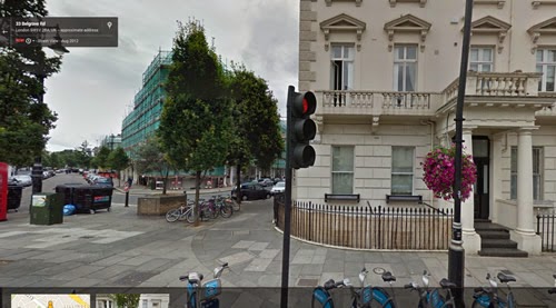
If you have typed in an address click on the Street View image in the top left corner of the screen for the street view of the street. You can also achieve a street view by clicking on the images at the bottom of the page or by moving the person icon on the bottom right of the screen to the area you want to explore.
To return to the traditional map click the map icon in the bottom left of the screen.
Google Maps also provides directions from one location to another. Click
the Directions icon in the top left of the search screen then type in
the start and finish points of the proposed journey. You can also choose
whether the journey is by car, walking or public transport.
As well as showing the route directions for travelling the route are provided.
You can also use the Street View feature to view the place to which you are travelling.


No comments:
Post a Comment